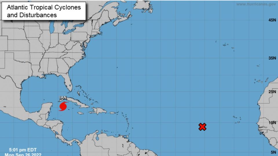
Hurricane Ian is expected to pass west of the Florida Keys on Tuesday night and approach the west coast of the same state between Wednesday and Thursday.
Hurricane Ian became a Category 2 after its winds rapidly increased from 85 miles per hour to 100 miles per hour as it approaches western Cuba.
According to the National Hurricane Center (NHC), at 5:00 p.m. local time, the eye of this system was found 155 miles southwest of the westernmost tip of Cuba.
“Conditions in western Cuba will deteriorate tonight with significant winds and storm surge expected,” the observatory said.
There is currently a hurricane alert for the Cuban provinces of Isla de Juventud, Pinar del Río and Artemisa , and a hurricane warning has been issued for Dry Tortugas, an islet west of Key West (Florida) and in the middle of the Gulf of Mexico.
So why so much disagreement still? The answer is, hurricane Ian still has to go through western tip of Cuba. Land interaction could have an affect on the storm's track/intensity. After crossing completely, we should know a lot more. Small deviations east or west can change a lot pic.twitter.com/YeiUjX4Fhe
— Greg's Weather (@greg_weather) September 26, 2022
There are different alerts in force for parts of the west coast of Florida, which will be the most punished once it passes through Cuba.
On the forecast track, the center of Ian is expected to move near or over western Cuba tonight and early Tuesday. It will then emerge over the southeastern Gulf of Mexico.
It is forecast to pass west of the Florida Keys on Tuesday night and approach the west coast of the same state between Wednesday and Thursday.
Getting a few questions about #Ian.@NHC_Atlantic track brings the storm into Florida and then into the southeast U.S as it weakens to a depression.
While remnant moisture from the storm will need to be tracked, high pressure is looking set to keep us dry this weekend.#nsstorm pic.twitter.com/q5NSNSNSsS— Ryan Snoddon (@ryansnoddon) September 26, 2022
Rapid strengthening is expected over the next few days and Ian is forecast to become a major hurricane tonight or early Tuesday when it is near western Cuba.
The cyclone is moving north-northwest at 13 miles per hour.
Hurricane-force winds extend outward up to 35 miles (55 km), and tropical-storm-force winds outward up to 115 miles.

