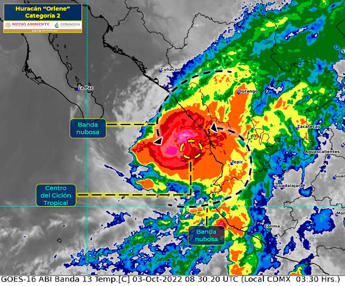
The morning of this Tuesday, October 3, Hurricane Orlene made landfall as a Category 1 hurricane, the eastern North Pacific National Hurricane Center reported.
According to the US agency, it was at 7:45 in the morning that the meteorological phenomenon impacted north of the border between Nayarit and Sinaloa, with estimated maximum winds of 140 km/h.
“Hurricane #Orlene makes landfall around 7:45 am MDT (1345 UTC) in southwestern Mexico, just north of the border between Nayarit and Sinaloa, with estimated maximum winds of 85 mph (140 km/h).”
For its part, the National Meteorological Service of Mexico (SMN), confirmed that Orlene made landfall and continues to move along the southern coast of Sinaloa as a Category 1 hurricane.
“At 8:45 a.m. Central #Mexico time, #Orlene made landfall as a Category 1 #Hurricane with maximum #Winds of 140 km/h and #Gusts of 165 km/h, 5 km west-southwest of Isla del Bosque, Escuinapa, in #Sinaloa,” the SMN said.
Given the impact of the hurricane, intense winds are forecast with gusts of 90 to 110 km/h and waves of 3 to 5 meters high on the coasts of Nayarit and Sinaloa; gusts of 60 to 70 km/h and waves of 2 to 3 meters high on the coast of Jalisco and gusts of 50 to 60 km/h with waves of 1 to 2 meters high on the coasts of Baja California Sur and Colima.
The meteorological phenomenon could also cause torrential rains in areas of Sinaloa and Nayarit; intense in Durango and Jalisco; very strong in Colima, as well as strong in Zacatecas, Aguascalientes and Guanajuato.

