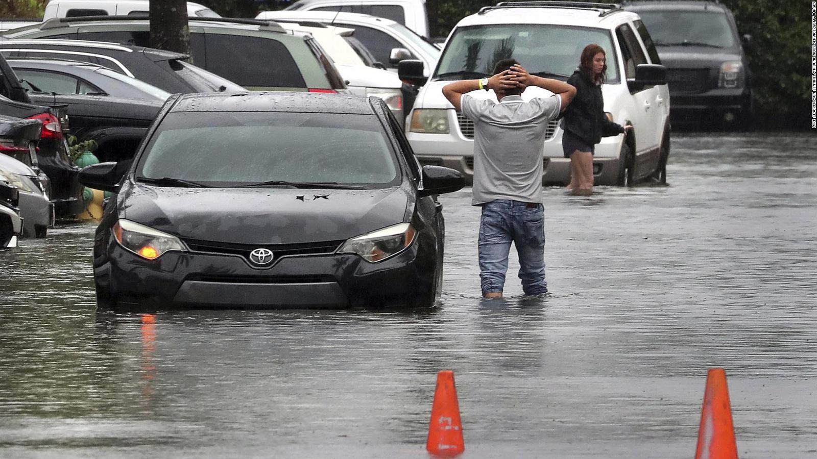
Tropical Storm Alex formed early Sunday after bringing heavy rain and flooding to South Florida a day earlier, becoming the first named storm of this year’s Atlantic hurricane season.
Alex was moving away from the Bahamas and headed for Bermuda this Sunday morning with sustained winds of 85 km / h. On Monday, the storm was expected to pass north of Bermuda, which is currently under a tropical storm warning. There may be gusty winds and 50 to 76 millimeters of rain.
“Slight strengthening is possible today (Sunday) followed by weakening beginning Monday,” the National Hurricane Center said.
As of early this Sunday, the United States and the Bahamas were no longer threatened by the storm.
On Saturday, the system hit South Florida with a trio of heavy rains, high winds and flooding, with up to 11 inches falling in some areas since Friday.
The city of Miami warned residents Saturday afternoon that several roads were not accessible. At least one beach was temporarily closed.
Officials with the Miami-Dade Fire Department warned that the danger of flooding over the weekend is “high” throughout the county, especially in low-lying and poorly drained parts, and urged residents not to attempt to walk or drive. through the flood waters.
About 100 vehicles were stranded in floodwaters across Miami from Friday through Saturday, Fire Chief Joseph Zahralban told Citizen Free Press affiliate WSVN.
The storm dumped record daily rainfall for June 4 in West Palm Beach (which recorded 114 millimeters of water), Fort Lauderdale (which recorded 165 millimeters) and Miami (which recorded 133 millimeters), according to the National Weather Service.
Another Above-Average Hurricane Season Forecast
Last month, the National Oceanic and Atmospheric Administration (NOAA) issued its forecast for this hurricane season.
NOAA forecasts an above-average year, with 14 to 21 named storms, six to 10 hurricanes, and three to six major hurricanes, Category 3 or higher.
There are several factors that contribute to a “busy” hurricane season.
“We’re in an active period,” NOAA Administrator Rick Spinrad said. “There are certain ingredients that drive the intensity and frequency of hurricanes.”
One is the existing La Niña conditions in the equatorial Pacific.
This phenomenon creates cooler than average ocean temperatures around the equator in the Pacific and results in climate impacts around the world.
La Niña presents favorable conditions for hurricanes in the Atlantic, in contrast to El Niño.
This Thursday, the Colorado State University (CSU) issued a Update on forecast. Now it calls for a hurricane season far above with 20 named storms, 10 hurricanes and 5 major hurricanes.
This is the most named storms CSU has forecast for the season in June, Phil Klotzbach, the forecast’s author, told Citizen Free Press. In 2020, the university’s forecast center forecast 19 storms during its June release, but that number included three storms that were named before the season began.

