What there is to know
- Despite the sunshine, Wednesday will remind us that we still have 12 days of winter left with a strong northwesterly wind making our temperatures 10 to 20 degrees cooler before plunging into the 30s and 20s this afternoon. and tonight.
- Thursday will be another cold and blustery day in the 40s before the next winter storm approaches Friday afternoon, bringing another round of wintry conditions to our region that will affect us from Friday evening through Saturday afternoon.
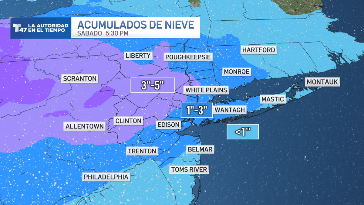
- For now, 1 to 3 inches of accumulations are expected in the city with smaller amounts along the Long Island and New Jersey coast, but higher amounts in northwestern New Jersey and the lower Hudson Valley. The high range of snow potential is around 5 inches in this area.
NEW YORK — Get ready! as the tri-state area could see more snow before winter ends in a few days.
Despite the sunshine, Wednesday will remind us that we still have 12 days of winter left with a strong northwesterly wind making our temperatures 10 to 20 degrees cooler before plunging into the 30s and 20s this afternoon. and tonight.
Thursday will be another cold and blustery day in the 40s before the next winter storm approaches Friday afternoon, bringing another round of wintry conditions to our region that will affect us from Friday evening through Saturday afternoon.
For now, it looks like points north and west of New York have the best chance of snow accumulation from this system. The latest pattern trends have accumulations of 1 to 3 inches across the city with smaller amounts along the Long Island and New Jersey coast, but higher amounts in Northwestern New Jersey and lower New Jersey Hudson Valley. The high range of snow potential is around 5 inches in this area.
Long Island and Connecticut have less chance of snow accumulation, according to current models.
Sunday will be the best day of the weekend with warmer temperatures and sunny skies. It will be the calm before the next storm with another system approaching Monday which could bring more rain and snow to our area to start the work week.


