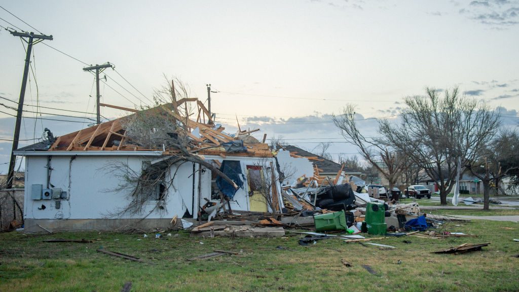
At least 23 people were injured Tuesday after tornadoes touched down in Bell County, Texas, according to authorities.
Twelve of the injured were hospitalized, Bell County Judge David Blackburn said, adding that he believes all are accounted for.
Two confirmed tornadoes touched down in Bell County, which is the central region of the state of Texas, the National Weather Service (NWS) Storm Prediction Center said.
On Tuesday, 911 calls reported a tornado around 5:40 p.m. local time, Blackburn said. A tornado crossed the county line from neighboring Williamson County, traveling 7 miles overland, he added.
Damage ranged from downed power lines and trees to flattened buildings, reduced to rubble in many areas, Blackburn said.
“I think it came up pretty quickly,” Blackburn said. “The extent of the damage is significant. At least at this point in time not having any reports of fatalities is in itself surprising.”
A dual-threat storm system produced at least eight tornadoes on Tuesday, primarily in Texas and Iowa, as well as heavy snowfall in several states, including the Dakotas, Montana and Minnesota.
Parts of the Dakotas and Montana were under blizzard warnings and forecasters warned of treacherous snow conditions on the roads.
Heavy snow closed more than 500 miles of Interstate 94 between Montana and North Dakota.
A mountainous area near Pony, Montana, recorded 47 inches of snow in a 24-hour period, according to the NWS. Many other parts of the state were hit by more than a foot of snow.
In North Dakota, more than a foot of snow was recorded in several locations, including Grand Forks and Rockford, according to NWS data.
“We do have blizzards in April, but one of this intensity is quite rare,” Jeff Schild, a meteorologist with the Bismarck weather service office, told Citizen Free Press early Tuesday. “The last of this level of intensity was April 4-7 in 1997.”
Severe weather threatens 97 million people this Wednesday
As the system moves east, it is producing a trio of threats: damaging winds, tornadoes, and large hail.
More than 97 million people are under some form of severe weather warning Wednesday, from Texas and Louisiana to Missouri and Illinois.
The biggest threats are expected in Memphis, Tennessee; Evansville, Ind.; Jonesboro Pine Bluff, and Little Rock in Arkansas; Owensboro, Kentucky – where more than 5 million people are at moderate risk (level 4 of 5). These cities could see high winds, tornadoes as well as large hail.
Overall, severe storms could affect a large portion of the lower and middle Mississippi Valley into the Midwest, as well as the lower Ohio Valley, the Storm Prediction Center said.
Elsewhere, parts of Montana, North Dakota and northern Minnesota could also see heavy snow on Wednesday. The snow is expected to end this Thursday, followed by extremely cold temperatures.
“Overnight lows will drop below zero degrees Celsius in western North Dakota, and with strong winds, wind chill will be in the single digits above or below zero (Farenheit), quite cold for mid April,” the Bismarck weather service office said.
On Friday, maximum temperatures will possibly reach 20 degrees (Farenheit), that is, about 30 degrees below normal. The region could break records for maximum low temperatures.

