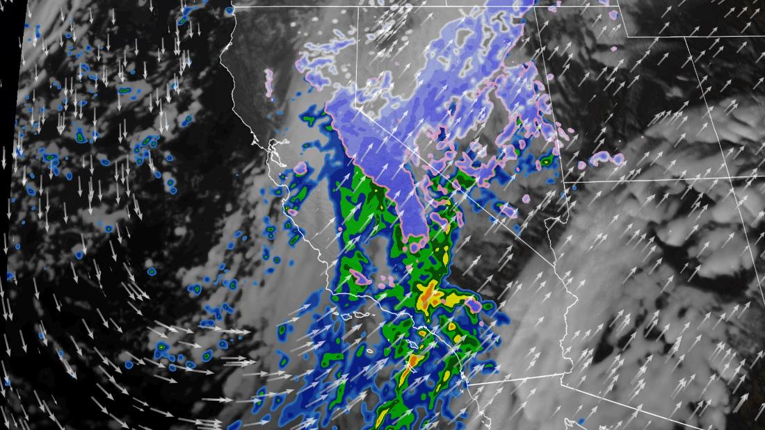
A weather system will impact the drought on the west coast of the United States and bring the biggest snowstorm of the season to California. Strong winds and heavy rains –– albeit welcome–– will also affect the region during the week.
The system is moving from the Gulf of Alaska inward and will slowly push dangerous conditions south – from the Pacific Northwest on Sunday to southern California on Tuesday.
What we know about the blizzard
This will be “easily the biggest snowstorm this season,” warned analysts at the National Weather Service (NWS) office in Sacramento during their discussion this Sunday morning.
And the reason is quite understandable.
Total snow is likely to reach 0.9 to 1.5 meters in the Sierra Nevada, with isolated areas that can receive up to 2.4 meters. Some regions could even experience snowfall rates of more than 5 centimeters per hour.
The forecast for snowfall until Wednesday. (Values are in inches).
In addition, the wind gusts approach 96.5 kilometers per hour. Which will cause low visibility conditions and therefore travel will be almost impossible.
There is also the possibility of avalanches, as well as downed trees and power outages. In fact, this Saturday an avalanche was registered near a ski resort in the Seattle area due to this system.
Outside the Sierras, the Olympic, Cascade and Northern Rocky Mountains are also forecast to receive 12 to 3 inches of snow.
Rains that are welcome
California continues to suffer record low levels in reservoirs and exceptional drought conditions.
The entire state is experiencing at least a moderate drought, with much of the central and southern regions facing extreme to exceptional drought.
Drought levels in the United States. The darker colors, which predominate on the west coast, represent extreme drought and exceptional drought. The graph represents data analyzed on Tuesday, December 7.
This is exactly where a powerful atmospheric river will form, unleashing an impressive wave of moisture.
And that moisture will fall in the form of heavy mountain snowfalls and torrential rains.
California’s coastal and valley regions, as well as the Pacific Northwest, will receive at least 12 to 3 inches of rain, which is much needed for these locations.
Some areas near the foothills of California could register 6 inches Tuesday night.
After having the second driest hydrological year ever recorded in 2021, which runs from October 1 to September 30, this is a welcome phenomenon.
Rain and snow cover are important in replenishing California’s water reservoirs. Which, precisely, are at levels low enough to force the emergency of water in the state and close hydroelectric plants.
Unfortunately, the rain will come with a price to pay.
As the Los Angeles National Weather Service office noted on Sunday morning, the rain “will cause a rush-hour traffic disaster on Tuesday.”
Additionally, too much precipitation too fast on dry, fire-scarred soils raises concerns about flash floods. Also due to the possibility of landslides in the coming days in central and southern California.

