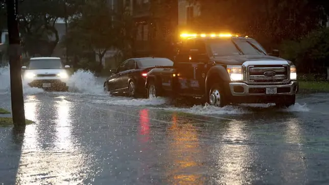
Much of Texas is under a flood warning. According to the NWS, these are the affected areas and how long they will last.
Bad weather continues to wreak havoc in the United States, this time in the Lone Star State. According to the National Weather Service (NWS), much of Texas is under a high flash flood warning.
According to the agency, southeast Texas will be hit by strong storms that will cause an accumulation of rainfall of between 3 and 5 inches; while in areas closer to the coast, flooding of between 7 and 8 inches is expected, although this will only be possible if the storm passes through the same place several times.
Secret Service Chief Resigns After Trump Rally Attack #USPolitics
Texas Flood Warning: Areas Affected
Since the most affected areas, i.e., those with a higher probability of flash flooding, are in the southeastern part of the state, rainfall accumulation can be expected in cities such as Houston, San Antonio, Austin and Corpus Christi.
“A flood watch will be in effect for most of southeast Texas on Wednesday. Wet ground conditions and heavy rainfall may result in flash flooding and river flooding. Storm drains clogged by debris from Hurricane Beryl may cause further flooding problems,” the NWS warned via social media.
How long will the flooding last?
While the NWS warning will be in effect through Wednesday, July 24, the risk of Level 2 flooding could extend through Thursday, July 25. Should weather conditions persist, Level 1 flash flooding could occur on Friday and Saturday.
Aurora Borealis Expected Over Northern US: Find Out Where to Look Up #NorthernLights

