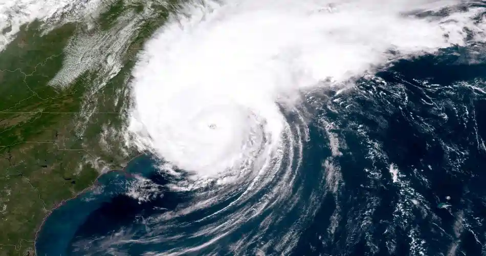
Hurricane Lee May Approach New York with Possible Impact on Tri-State Area
Hurricane Lee, now a Category 3, is expected to leave heavy rain and intense wind conditions, with dangerous rip currents and swells of 9 to 12 feet high in the New York tri-state area
Hurricane Lee, which is currently hovering over the Atlantic Ocean, has become a massive storm.
After being named a tropical storm last Wednesday, Lee quickly intensified and became a major Category 5 hurricane Thursday night.
The cyclone went from 80 mph winds to 160 mph winds in just 24 hours, becoming part of the infamous group of hurricanes that have intensified in less than a day. On the list is 2005’s Wima, Felix in 2007, 2008’s Ike, 2016’s Matthew, 2017’s Maria and 2020’s Eta. All of the storms lashed the population after their passage and their names were retired.
Lee is the eighth Category 5 storm since 2016. High temperatures at this time of year on the surface of the Atlantic Sea have contributed to the cyclone’s strength.
The hurricane continues to scourge the Atlantic, now as a Category 3 storm with 115 mph winds.
Forecast models have slowed the storm’s movement, so by Thursday it is at the same latitude as Florida, but a few hundred miles to the east.
While it has been agreed that Lee will not make landfall on the east coast, that is still not entirely ruled out and the situation should be monitored closely.
High surf, dangerous rip currents and local beach erosion are expected next week, CBS News reported.
Also, Tropical Storm Margot is churning in the Atlantic and is expected to become a hurricane next week. So far Margot poses no threat at this time.
Possible impacts from Lee in the New York tri-state area.
-Jersey Shore: Some windy conditions, 9 to 12 foot high surf, dangerous rip currents and beach erosion.
-Long Island: Moderate to severe thunderstorms forecast, particularly to the east. Winds variable in intensity, with gusts of at least 40 mph. High surf, dangerous rip currents and beach erosion.
-New York: Some showers expected, but generally cloudy and breezy. City beaches will have strong high surf of 9 to 12 feet, dangerous rip currents and beach erosion.
-Hudson Valley, northern and central New Jersey, Connecticut: Over these areas there will be little effect other than some clouds and breezy conditions from time to time.
Lee’s end will depend on two systems. One is Tropical Storm Margot, which is in the eastern Atlantic, and an upper-level trough that is set to develop off the East Coast late next week.
It is believed that Margot may develop into a hurricane early next week, but is not expected to affect any landmasses. However, Margot may have an influence on what happens with Lee. If it gets too close to Lee, it may absorb some of the energy, weakening it.

